New England Fall Foliage Road Trip: 7-day itinerary & map
White Mountains, Green Mountains and the Berkshires
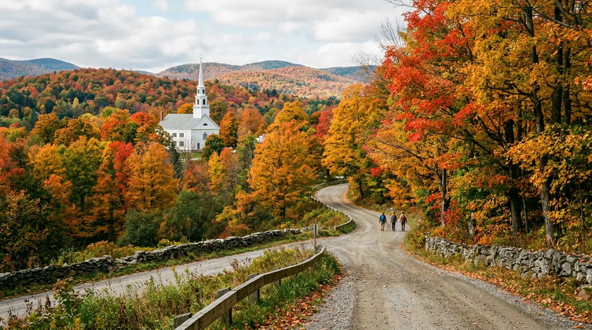
This loop from Boston follows the leaves. It heads north first to the White Mountains, where colour tends to turn earliest, then west across Vermont's covered-bridge towns and south through the Berkshires. Leave some slack in the schedule: peak colour moves from week to week.
When to go: Late September to mid-October. Colour usually peaks in the north first and moves south over about three weeks.
Map loads when you scroll here…
Route line and mileage from OSRM over OpenStreetMap roads. Open this route in the planner to change the stops.
Day-by-day New England Fall Foliage Loop itinerary
- Start
Boston
Leave early to beat the city traffic heading north on I-93.
Pass through - 137 mi · about 3 h 12 min from Boston
North Conway
Drive the Kancamagus Highway's 34 miles of hardwoods. On a clear day, add the Mount Washington Auto Road or the Cog Railway.
2 nights here - 115 mi · about 2 h 48 min from North Conway
Stowe
Take US-2 across to Vermont. Smugglers' Notch, the Stowe Recreation Path and a cider mill all fill a slow day.
2 nights here - 73 mi · about 1 h 48 min from Stowe
Woodstock
Come south on VT-100, Vermont's spine road. Woodstock has three covered bridges and the Marsh-Billings-Rockefeller forest trails.
1 night here - 156 mi · about 3 h 18 min from Woodstock
Lenox (Berkshires)
The Molly Stark Trail leads to the Berkshires. See the Mohawk Trail overlooks and Mount Greylock, the highest point in Massachusetts.
1 night here - 130 mi · about 2 h 42 min from Lenox (Berkshires)
Boston
Take the Mass Pike back east, about two and a half hours.
End of the trip
Before you drive
- Peak dates change every year. Use the state foliage reports rather than a fixed date.
- Weekend traffic on the Kancamagus Highway can crawl in peak season. Drive it on a weekday morning.
- Book autumn lodging early, especially in Stowe and North Conway.
Fuel for this trip
At 28 mpg and $3.50/gal, 611 miles costs about:
$76
Price is a placeholder. Enter what you're seeing locally. Full gas cost calculator
New England Fall Foliage Loop FAQ
How long does the New England Fall Foliage Loop road trip take?
This itinerary takes 7 days and covers about 611 miles, or roughly 14 hours of driving without traffic or stops. You can drive it faster, but the nights listed leave time for the sights.
When is the best time for a New England Fall Foliage Loop road trip?
Late September to mid-October. Colour usually peaks in the north first and moves south over about three weeks. Check official road status before you go.
What is the longest driving day?
Woodstock to Lenox (Berkshires): about 156 miles, or 3 h 18 min of driving before stops. Leave early that day.
Where should I stay overnight?
The overnight bases in this plan are North Conway, Stowe, Woodstock, Lenox (Berkshires).